NASA Satellite Records Unprecedented Triple of Major Pacific Hurricanes Amid Strong El Niño
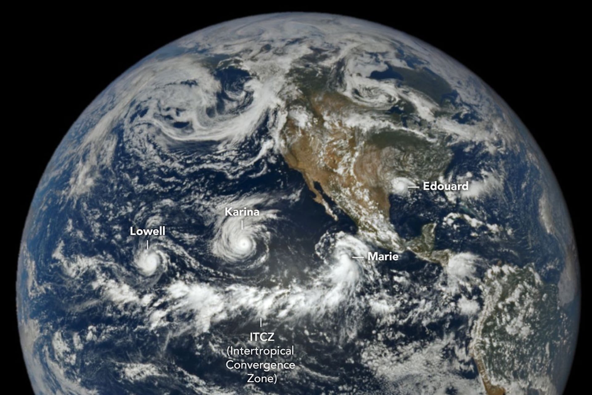
A NASA satellite orbiting close to a million miles above Earth has documented an extraordinary weather event: three powerful Pacific cyclones – two reaching Category 4 strength and one attaining Category 5 – existing at the same time. Scientists say the concurrence is a direct outgrowth of the current “super” El Niño, a period of unusually warm ocean temperatures that is reshaping storm patterns across the globe.
El Niño, the warm phase of the El Niño‑Southern Oscillation, typically drives higher sea‑surface temperatures in the central and eastern Pacific. When the anomaly intensifies beyond normal bounds, it is labeled a “super” El Niño, a condition that can amplify tropical cyclone formation by providing more heat energy and moisture to developing storms. The present episode ranks among the strongest on record, prompting forecasters to watch for heightened activity in basins that are usually less active.
The three cyclones, identified by the satellite’s infrared and visible sensors, are situated at widely separated longitudes but share a common fuel source: the anomalously warm waters generated by the El Niño. Two of the systems have been classified as Category 4 hurricanes, with sustained winds exceeding 130 mph, while the third has achieved Category 5 status, surpassing 156 mph. Such intensity is rare in the Pacific, and the simultaneous presence of three major storms is unprecedented in the satellite era.
NASA’s geostationary platform, positioned near the equatorial plane at roughly 1 million miles altitude, offers continuous, high‑resolution monitoring of the Pacific basin. Its instruments captured the storms’ eye walls and cloud tops in real time, providing the first clear visual confirmation that multiple high‑category cyclones can coexist over the same ocean basin during a single El Niño cycle.
The observation carries weight for both operational forecasting and climate research. Meteorologists can now refine models that predict rapid intensification, while climatologists gain a concrete example of how extreme oceanic heat can translate into amplified storm severity. The data also underscore the importance of satellite vigilance, especially as coastal communities in the Pacific Rim prepare for potential impacts.
Historically, the Pacific has produced Category 4 and 5 hurricanes, but they have almost always occurred in isolation or with significant time gaps. Records dating back to the 1970s show only a handful of such high‑intensity storms in any given season, and never three at once. The current trio therefore sets a new benchmark for storm clustering under extreme climatic conditions.
Looking ahead, agencies are closely tracking the storms as they move westward, assessing threats to island nations and offshore vessels. The episode also adds urgency to discussions about climate resilience, as scientists anticipate that future super El Niño events could make similar multi‑storm scenarios more common. Continued satellite surveillance will be critical for early warnings and for expanding the scientific understanding of how a warming ocean reshapes the planet’s most powerful storms.



Comments (0)
Be the first to comment.
Join the discussion