Potential Hurricane Emerges from Gulf Low-Pressure System as October Begins
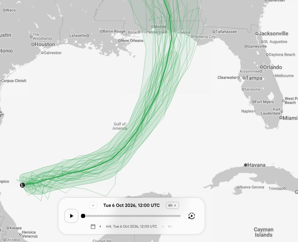
National Hurricane Center forecasters are watching a developing low-pressure area in the western Gulf of Mexico that is expected to reach tropical storm strength within the next 48 hours, and the latest ensemble of computer models give it a respectable chance of intensifying into a hurricane before making landfall.
The disturbance, currently situated off the coast of Texas, has already begun to organize its convection and acquire a tighter pressure gradient. Recent model runs from the European Centre for Medium-Range Weather Forecasts and the American Global Forecast System both show a steady increase in wind speeds, with some scenarios projecting sustained winds exceeding 74 miles per hour as the system moves northeastward toward the Gulf Coast.
While the Atlantic hurricane season, which runs from June 1 to November 30, routinely produces storms in early October, the timing and location of this system have drawn particular attention. Historically, storms that form in the Gulf during this period can tap warm sea‑surface temperatures and favorable upper‑level winds, creating conditions that support rapid strengthening. The prospect of a hurricane forming at this stage of the season adds a layer of urgency for communities that are still recovering from previous storms.
Coastal residents from southern Texas to the western Florida panhandle are being urged to review evacuation routes and emergency supply kits. Even if the system remains a tropical storm, heavy rainfall and storm‑surge flooding could pose significant risks to low‑lying areas, especially as the Gulf’s shallow waters tend to amplify surge heights. Local authorities have begun pre‑positioning resources and updating public advisories in anticipation of the system's approach.
Forecasters emphasize that the outlook remains fluid. The National Hurricane Center will issue its first official advisory once the system meets the criteria for a tropical cyclone, and subsequent updates will refine the projected track and intensity. Model consensus currently favors a northeastward path that could bring the storm inland over Louisiana or Mississippi, but slight variations in steering currents could shift the threat eastward toward the Florida peninsula.
In the coming days, meteorologists will monitor the system’s core structure, satellite imagery, and reconnaissance data to gauge its development. Residents are advised to stay informed through official channels, heed any watches or warnings, and avoid complacency even if the storm ultimately remains below hurricane strength. The coming week will determine whether the Gulf low‑pressure system becomes the season’s next major threat or dissipates without severe impact.



Comments (0)
Be the first to comment.
Join the discussion